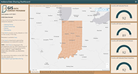
Indiana Data Harvest homepage.
The Data Harvest project updated by the state Geographic Information Office and Polis received the Special Achievement award at the Indiana Geographic Information Council (IGIC) conference. This award recognizes special geospatial projects developed through teamwork that demonstrate commitment to working with others in the Indiana GIS community toward a common goal, while performing important, often pioneering work, to create an outstanding information resource.
Although the state led the effort since 2008, this was the first time Polis was a key supporter. From September to December 2020, the Polis Center processed, standardized, and augmented the contributed data with additional information. During the first quarter of 2021, the team integrated the data into the state’s internal databases, developed a new statewide geocoder, finalized documentation, and made the data available to the public for download.
Marianne Cardwell, Polis GIS Project Coordinator, explains Polis involvement here.

